


Long before Jan van Riebeeck landed at the Cape, Portuguese explorers charted the bay in the 15th and 16th centuries, the first being Bartolomeu Dias in 1487.
Ninety years later Manuel de Perestrelo aptly called it Bahia Formosa or the Beautiful Bay. The first European inhabitants were 100 Portuguese sailors marooned here for 9 months when the São Gonçalo sank in the bay in 1630.
The survivors built two small boats which they used to link with a passing vessel. A stone that they left behind on Beacon Island, known as the Van Plettenberg Stone, is now in the Cape Town museum.
 In 1763, the first European settlers in the Bay were stock farmers, hunters and frontiersmen from the Western Cape.
A stinkwood navigational beacon was first erected on Beacon Island in 1771.
The original was a square block of stinkwood, inscribed with the latitude and longitude of Plettenberg Bay and erected to enable mariners to check their location.
It was replaced by a stone one by Captain Sewell in 1881.
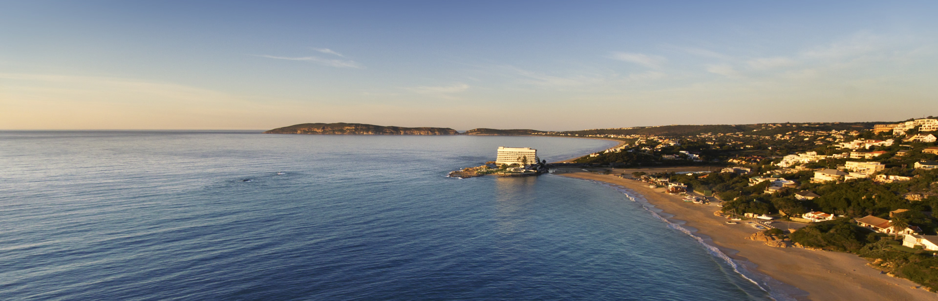
The bay housed a barracks for the Dutch East India Company in 1776. The Governor of the Cape, Baron Joachim van Plettenberg, renamed the town Plettenberg Bay in 1779.
In 1869 the barracks was bought by St Peters Church and used as a rectory for the next 70 years.
Today it is the privately owned Old Rectory hotel & spa.

In 1787/88 Johann Jerling erected a timber shed commissioned by the Dutch East India Company; the remains can still be seen and are preserved as a provincial heritage site.
In the 1830s, Plettenberg Bay was a stopping point for ships traveling through during the winter time, heading to India.
As of 1833, the population of Plettenberg Bay was estimated around 400, with half being white, according to diplomat Edmund Roberts who visited the area. Edmund Roberts noted that the bay had a large abundance of cattle and sheep.
He also recognized ‘the excellence of its butter’ and a timber industry.
Well-known Plett thespian, raconteur and committee member of The Van Plettenberg Historical Society, David Hall-Green, tells us about the ill-fated Portuguese ship, known to us as the “San Gonzales”, which ran into serious trouble in our bay.
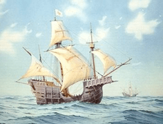
1630: Padrão of the São Gonçalo It seems that a group of about 100 sailors off the Portuguese trading ship, São Gonçalo, were the first Europeans who spent any significant amount of time in the area we now call Plettenberg Bay. They were en route back from India to Portugal in 1630, carrying a cargo of pepper. They had actually stopped in the bay to make some repairs to the ship when a huge storm hit the bay and claimed the ship as well as 150 of their crewmen. The 100 survivors managed to swim ashore and made the Piesang Valley their home for about 8 months, befriending the Khoisan as they did so and building a church. They spent their time here building 2 boats from the remains of the São Gonçalo and the timber supplied by the surrounding forest. Just before they left the Bay, they erected a stone marker (padrão) on the shore. This was the first ‘Plett beacon’. The padrão was re-discovered in 1980. It bore the inscription (in Portuguese) “Here was lost the ship São Gonçalo in the year 1630.” Sadly, the story of the São Gonçalo ended in even further tragedy: although the sailors were eventually picked up by other ships of the Portuguese fleet who brought them back to Portugal, one of those ships sank just as it entered the Lisbon harbour, with the loss of everyone on board – including some of the survivors of the São Gonçalo.

Nelson Bay Cave on Robberg and Matjies River Cave at nearby Keurboomstrand were inhabited for over 100,000 years by Middle Stone Age man and then later by ancestors of the Khoisan, who were possibly the same people who traded with the Portuguese survivors of the Sao Gonzales shipwreck.
Sometime Norwegian Whaling Station | Beacon Island as it was when the hub of whaling operations (1913-16)
The house was imported from Norway, was occupied by project manager Captain Jacob Odland. It remained when whaling ceased, becoming Hopwood’s boarding house, forerunner of the Angler’s Inn; the first Beacon Island Hotel (single-storey); and later Southern Sun hotel.
Beacon Island as it was when the hub of whaling operations (1913-16)

The door in the east wall of the house, thought to have been the original main entrance
The following article, looking at the history of the Old Rectory in Plettenberg Bay, was written by Patricia Storrar and appeared in the 1981 edition of Restorica, the journal of the Simon van der Stel Foundation (today the Heritage Association of South Africa). For current details on the structure and more history of Plettenberg Bay contact us. Thank you to the University of Pretoria (copyright holders) for giving us permission to publish.
Historically speaking, by far the most important building in Plettenberg Bay is the one known today as the Old Rectory. It is one of the few substantial structures in the Eastern Cape remaining virtually intact from the days of the Dutch East India Company. It adjoins the Old Timber Shed, which was proclaimed a National Monument in 1964 but is older than the latter by 10 years.
The first evidence that there was a fairly large building on this site in 1777 appears on a map of that year by an unknown cartographer, on which it is marked as “Verblijf voor het valk”. On J .C. Frederici’s better-known map of the “Platte Grond van S.E. Compagnies Post in de Plettenberg’s Baay”, drawn 12 years later, the structure is marked as “Project tot de Militaire Logies” and on another Frederici plan of the same period as “Militaaren Logies”.
It was not surprising that it was thought necessary to house some military personnel at the Bay (then thought to be a promising harbour) towards the end of the 18th century, because of the unsettled state of affairs in Europe. Holland’s declaration of war on Britain in 1780, Britain’s attempt to capture the Cape in 1781, the French Revolution in 1789, the Revolutionary Wars of 1792 and finally the occupation of the Cape by the British in 1795 – all these events would have made those controlling the affairs of the Dutch East India Company nervous about the possibility of an attempted landing by a hostile power on this lonely stretch of coast.
Van Plettenberg Beacon – The beacon can be seen at the lookout point on the corner of Hopwood and Meeding Street.
During 1778, Governor Joachim Baron van Plettenberg visited many of the outposts throughout the Cape Colony. He arrived in the bay, then known as Bahia Formosa (Beautiful Bay as named by early Portuguese explorers) on 5 November 1778. 
After inspecting the bay and surrounding area, he erected this slate possessional stone indicating that the bay henceforth would belong to the Dutch East India Company. From that day on the town also bore his name, Plettenberg Bay
![]()
All indications are that from the time the timber shed was reconstructed in 1787 (it is shown as an ”ingevalle hout huis” on the map of 1777) the substantial house next to it was used to house employees of the Company, who supervised the storing of timber in the hout huis and arranged for its shipment to the Cape.
There is no mention in the records of any alterations being made to the militaaren fogies (the house which is the subject of this article) until 1887, when the two wings of the building were joined and a new roof of corrugated iron replaced the worn-out thatch. Everything indicates, therefore, that the main structure stands today very much as it did two centuries ago.
It is quite likely that the house may have fallen empty during the first British occupation (Johann Friedrich Meeding, the Postholder had by then built his own fine house but it was reoccupied early in the 19th century and from the time of the First Britsh Occupation onwards became known as The Barracks.
The most noteworthy occupant of the house in the first half of the last century was John Archibald Sinclair, the first man to undertake whaling professionally in Plettenberg Bay. He and his wife, Julia Maria (eldest daughter of the first Government Resident of the Bay, Captain Robert Charles Harker) seem to have lived here from the time they were married until his death in 1859. Both Sinclair and his wife were keen supporters of the first chapel to be built in Plettenberg Bay, St. Andrew’s Chapel, Redbourn (built 1850/51) and it was understandable that they, being owners of the only roomy, important house in the Bay, should be among the first to entertain Bishop Robert Gray, first Bishop of Cape Town, on some of his visits to the isolated little community.
In 1850, for instance, the Bishop and the local catechist, Charles Bull, had an early breakfast with the Sinclairs before riding to Redbourn where the Bishop was to conduct a service. In 1855, on his next visit, the Bishop recorded: “I then proceeded to Captain Sinclair’s, where Divine Service is now held, and who had prepared dinner for us”. The story has long persisted that the Bishop actually held services in the little barn, or stables, on the north side of the house, but there does not seem to be documentary evidence for this. This barn was, however, definitely used for church services after mid-1875, which was when the small wooden St. Peter’s Chapel, built on the hillside where the stone Church of St. Peter now stands, was blown down in a gale. The barn also served as a school towards the end of the last century and early in this one.
In May 1854 Johan Frederik Victorin, the young Swedish naturalist who spent several months in the Knysna/Plettenberg Bay area collecting specimens, described the already-old house thus: “The dwelling-house is situated only a few hundred alnar from the beach, so that you hear the rather overwhelming thunder of the breakers.” The noise of the surf is still, of course, a background to all activities in the house.
After Sinclair’s death, the Government bought this house for £1000, but was able to let it for only £80 a year. In 1869 Bishop Gray, on behalf of the Church, bought it together with 18 acres of land along the foreshore, commanding access to the landing ground, for a mere £220_17. “The property will even yet, I trust, become valuable to the Church”, wrote Bishop Gray. “At all events it offers an excellent residence for our Missionary.”
From this date onwards it was known as The Parsonage or The Rectory. A long succession of gentlemen of the cloth, supporting their families on stipends of £100 a year or less, were to call this building “home” for the next 70 years. The Rev. Edwin Gibbs occupied it briefly with his wife and children and then on a more permanent basis from 1870 until his death in 1891. It was during his tenancy that we find the first reference to the fact that the thatched roof badly needed repair.
Bishop West Jones, successor to Bishop Gray, stayed with the Gibbs family when he came to consecrate St. Peter’s Church on 14 August 1881 and here suffered a mishap. He ventured up a ladder to examine one of the gables of the house and suffered a fall, hurting himself so badly that he was not able to consecrate the Church of St. Michael’s and All Angels at The Crags the following day.
The Bishop promised on this occasion to pay half the cost of re-roofing the house with corrugated iron, as the thatch was badly rotted and was leaking seriously. At the same time as the roof was repaired in 1887, the courtyard between the two sections of the house was roofed over and the long building on a continuous plan, the one seen today, emerged. A passage runs the full-length of the building from east to west, with the rooms running off it on the south side.
After Gibbs’s death, the Rectory was occupied by the curate, William Breach (who was never ordained) and his large family until his death in June 1909. For the following decade the Rev. W. Gratton Sharples was the occupant. It was during his tenancy, in October 1913, that the famous author, Pauline Smith, and her aunt stayed in the Rectory. Miss Smith left a detailed description of the house, the approach to it down a precipitous hill, the garden, the furniture and the built-in features. Of the working quarters she wrote: “The kitchen has no stove but a fireplace about four yards wide and two deep, and about two feet raised, making it a sort of platform. In the middle of this two big stones across which are two flat iron bars under which the fire is made.” The opening of this fireplace is still to be seen, although a coal stove now fills it.
From the time that the present-day Rectory, near to the church was built in 1939, the historic building below became known as the Old Rectory. The present owner has called the whole property (part of which has recently been sold for town-house development) “Van Plettenberg Park” but the name “Old Rectory” lingers on. The Anglican Church sold the building with several acres of land in 1940 (some of the 18 acres bought by Bishop Gray in 1869 had already been sold off). The purchaser, Mr Fletcher, owned it briefly, until the late Mr Robert John Crawford Brunt became interested in the building. He began negotiations to purchase it in 1942 but the deed of transfer was not registered until the 16th September 1946. In the almost 40 years she has occupied the house, Mrs Crawford Brunt has made only one structural alteration (knocking out a section of the passage wall to increase the size of the sitting-room) but has covered the rotting yellowwood ceilings and floors, repaired broken sections of the 60 cm walls and generally done valuable work in keeping the two-centuries-old building in good repair. In 1981 Mrs E. Crawford Brunt sold 1,8 hectared of the land to Rengus Development Corporation. The steadily-increasing section of our populace which is interested in conserving buildings of historic importance such as this one, will surely take steps to ensure that this house with its fascinating history is not lost to the nation.
Article Credit http://theheritageportal.co.za/article/short-history-plettenberg-bays-oldest-surviving-building
Their tools, ornaments and food debris can be viewed in these caves, which are still being excavated. A whaling station on Beacon Island closed down in 1916.

Parts of the iron slipway are still visible today. A hotel called The Beacon Isle was built on the site of the whaling station. This was replaced by the iconic Beacon Isle Southern Sun Resort which opened for business in December 1972. This building, designed by André Hoffe, has a layered atrium which pays tribute to the Guggenheim Museum of Frank Lloyd Wright.
Between 1960 and 1990 Plettenberg Bay holiday resort expanded dramatically, extending along Robberg Beach (‘Millionaire’s Row’), and back towards the N2. During the apartheid period property within Plettenberg Bay was designated for whites only, with segregation of the beaches and toilet facilities. New Horizons, across the N2, was designated as a settlement area for colored people in 1968. As the 1980s progressed informal settlements of Xhosa migrants grew up around the edges of New Horizons and in the area of KwaNokuthula which became a town.
Although Plettenberg Bay escaped most of the violence associated with the end of apartheid, the assassination of Chris Hani in April 1993 led to a protest march into the town from KwaNokuthula, during which industrial premises on the outskirts of the town were burnt to the ground.
Formal segregation ceased with the repeal of the apartheid laws, but the consequences of the previously segregated property ownership remain highly visible to this day.
Local vegetation varies from Cape Fynbos to Knysna-Amatole montane forests further inland. The best examples of the original indigenous forest are to be found in the gully of the Keurbooms River, home to Knysna Loerie and Fish Eagles. Robberg Peninsula is essentially a Fynbos reserve. Robberg Peninsula – is the home of the Cape Fur Seals
Plettenberg Bay hosts one of the largest seagull breeding colonies along the South African coast at the mouth of the Keurbooms River, named after the indigenous Keurbooms tree. There are many pelagic birds in the area as well as the endangered African oystercatcher which live along the shores.
The Robberg Peninsula is home to a large Cape Fur Seal colony, seals can often be seen in the surf off Robberg Beach.

Great white sharks, attracted by the seal colony, can also be spotted from the high ground of Robberg Peninsula.
Southern Right Whales are a common sight in the bay during their breeding season from July to December. Bryde’s whales frequent the bay throughout the year being the most sighted during the summer months.
Humpback whales migrate past during July and December. Killer whales (orca) are occasionally sighted. Whales can be viewed from various viewpoints in the town as well as from Robberg Peninsula.

Plettenberg Bay also boasts three species of dolphins which visit the bay throughout the year, these being the bottlenose dolphin, the common dolphin and the endangered indo-pacific humpback dolphin.
The Bay falls within the Agulhas Bank ecoregion (bioregion), specifically within the Agulhas inshore ecozone. There has been a long history of sport fishing from the rocks, ski boats launched from Central Beach, or in Keurbooms estuary.
The sea life activity both surface and sub-surface varies considerably as either deep water upwelling brings cold water into the Bay, or warm water eddies over from the Agulhas Indian Ocean current offshore.

A distinctive flower-shaped sea shell called a pansy shell is endemic to this part of the coast, and is used as the symbol representing the town. Looking for these shells on the beach at low tide is a popular activity amongst visitors and locals alike.
Robberg Peninsula (Robberg Nature Reserve), situated close to the Plettenberg Bay on the Garden Route. ‘Rob’ in Afrikaans is ‘seal’, so the place is literally called ‘the seal mountain’. The extension on the right is ‘the Island’ – a small rocky area connected with the peninsula by the narrow strip of sand.

Robberg Island is built up by conglomerates of Robberg group and is a beautiful home of many marine bird species, reptiles, seals and indigenous plants. The Nelson Bay Cave, situated on the Robberg Peninsula, is one of the oldest caves, inhabited by human.
The town is highly seasonal; with a large proportion of second homes used exclusively during peak holiday periods. Popular with domestic and foreign tourists alike, many make it a stop along the garden route to visit local attractions such as Robberg Peninsula Nature Reserve.
The world’s largest free-flight aviary Birds of Eden, Sea Kayaking and Whale Watching, as a base to start the Coastal Otter Trail, Monkeyland Primate Sanctuary or a host of other outdoor activities on offer.

Although George and Port Elizabeth Airports are both within 1 and 2.5 hours drive away and offer frequent domestic and select international flights, CemAir also restarted regular direct flights from Plettenberg Bay Aerodrome to Cape Town International Airport and Johannesburg’s OR Tambo International Airport.